The question of Earths size has captivated thinkers for millennia. From the Ancient Greeks attempting philosophical estimations to early navigators piecing together rudimentary maps, humanity has long yearned to know the true dimensions of its home. Before the late 17th century, however, attempts to measure a degree of latitude – a crucial step in determining Earths circumference – were fraught with inaccuracies. Existing methods, while often ingenious for their time, suffered from limitations in instrumentation and the sheer difficulty of conducting precise measurements over vast distances. The world was waiting for a breakthrough, a measurement so precise it could serve as a new foundation for astronomy, cartography, and even physics.
A New Era of Precision: Enter Jean Picard
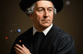
Jean Picard (1620-1682) emerged as a key figure in this scientific quest. A French abbé, astronomer, and geodesist, Picard was one of the founding members of the French Académie Royale des Sciences and played a pivotal role in the establishment of the Paris Observatory. He was a man of meticulous habits and a keen understanding of the latest technological advancements. The scientific revolution was in full swing, and the spirit of empirical investigation, championed by figures like Galileo and Kepler, demanded ever more accurate data. Picard was perfectly positioned to meet this demand.
His task was clear: to measure a degree of latitude with unprecedented accuracy. This was not just an academic exercise; it had profound practical implications. Accurate maps depended on it, as did the ability to determine longitude at sea, a problem that vexed mariners for centuries. Moreover, emerging theories about the nature of gravity and the shape of celestial bodies were hungry for precise terrestrial measurements.
The Triangulation Triumph
Picards approach built upon the principle of triangulation, a method already used by surveyors like Willebrord Snellius earlier in the century. However, Picard brought new levels of rigor and superior instruments to the task. The basic idea of triangulation is to measure a baseline distance very accurately, and then to measure the angles from the ends of this baseline to a distant point, forming a triangle. Knowing one side (the baseline) and two angles, the lengths of the other sides can be calculated using trigonometry. By extending this process, creating a chain of triangles, distances over large areas can be determined without having to physically measure every single leg.
A critical element was the accuracy of the initial baseline. Picard laid out his primary baseline south of Paris, near Villejuif, measuring it multiple times with carefully prepared wooden rods. He understood the potential for these rods to expand or contract with changes in temperature and humidity, taking precautions to minimize such errors. This initial measurement was the bedrock of his entire survey.
Revolutionary Instrumentation
What truly set Picards work apart was his use of instruments equipped with telescopic sights. Before this, surveyors used open sights, similar to those on a rifle, which were inherently less precise. By attaching telescopes, often with crosshairs (micrometer wires), to his quadrants and other angle-measuring devices, Picard could sight distant landmarks and stars with far greater accuracy. This innovation alone represented a giant leap forward in geodetic surveying.
Furthermore, for his astronomical observations to determine latitude, Picard utilized pendulum clocks, recently improved by Christiaan Huygens, for precise timekeeping. Determining latitude involved measuring the altitude of a star as it crossed the meridian (its highest point in the sky). Knowing the stars declination (its celestial latitude) and its observed meridian altitude allowed for the calculation of the observers terrestrial latitude. Accurate timekeeping was essential for ensuring the star was observed precisely at its meridian passage.
Picards innovative use of telescopic sights on his instruments dramatically improved the precision of angular measurements. This, combined with meticulous baseline measurements and improved astronomical techniques, set a new standard for geodetic surveys. His work was a testament to the power of combining careful methodology with cutting-edge technology.
The Paris-Amiens Meridian Arc
Between 1669 and 1670, Picard undertook his ambitious survey. He chose to measure a section of the meridian passing through Paris, extending it northwards to Sourdon, near Amiens, and southwards to Malvoisine. This Paris-Amiens arc provided a substantial length over which to average out minor errors and obtain a reliable value for a degree of latitude.
The process was painstaking. Picard and his team moved across the French countryside, identifying suitable high points for their triangulation stations – often church towers or hilltops. At each station, they would meticulously set up their instruments, taking multiple angular readings to various other stations. Weather conditions, terrain, and the sheer logistical challenges of transporting delicate instruments would have added to the difficulty. Imagine the patience required, the repeated observations, the careful recording of data day after day.
His astronomical observations for latitude were conducted at the ends of his measured arc. He selected a star, Scheat (Beta Pegasi), which passed very near the zenith at his northernmost station, minimizing errors due to atmospheric refraction. This careful choice further enhanced the accuracy of his latitude determinations.
A Degree Defined: The Landmark Result
After completing his measurements and calculations, Picard announced his result: one degree of terrestrial latitude corresponded to 57,060 toises. A toise was an old French unit of length, approximately 1.949 meters. This translates to about 111.21 kilometers per degree. This figure was significantly different from, and more accurate than, previous estimates. For instance, Snelliuss earlier measurement was around 55,000 toises, and older, rougher estimates were even further off.
Picards value was remarkable for its time. While not perfect by modern standards (todays value is closer to 111 km at the equator, varying slightly with latitude due to Earths oblateness), it was an order of magnitude more precise than anything achieved before. It was a number that scientists could trust and build upon.
Echoes Through Science: Picards Enduring Legacy
The impact of Picards measurement was profound and far-reaching. Perhaps its most famous application came from Sir Isaac Newton. Newton was grappling with his theory of universal gravitation and needed an accurate value for Earths radius to test whether the Moons orbit could be explained by the same gravitational force that causes an apple to fall on Earth. Early attempts using less accurate Earth measurements had not yielded a good match. Legend has it that when Newton learned of Picards new, more accurate value for the degree of latitude, he revisited his calculations.
Using Picards data to derive Earths radius, Newton found that his theory of gravity beautifully predicted the Moons orbital period. This was a cornerstone moment in the history of science, providing strong empirical support for one of its most fundamental theories. Without Picards meticulous fieldwork, Newtons “aha!” moment might have been delayed or less convincing.
Mapping the World Anew
Picards work also revolutionized cartography. With a reliable measure of a degree, maps could be drawn with far greater accuracy, transforming navigation and trade. The French government, recognizing the strategic importance of accurate maps, sponsored further geodetic surveys based on Picards methods, notably by the Cassini family (Jean-Dominique Cassini and his descendants), who would go on to produce the first comprehensive map of France based on rigorous triangulation.
Interestingly, while Picard initially worked under the assumption of a perfectly spherical Earth, the increased accuracy of his and subsequent surveys began to hint at something else. Small discrepancies in measurements taken at different latitudes suggested that the Earth might not be a perfect sphere after all. This paved the way for later expeditions, such as those to Lapland and Peru in the 1730s, which definitively proved that the Earth is an oblate spheroid, slightly flattened at the poles and bulging at the equator. Picards precision was a necessary stepping stone to this more nuanced understanding of our planets shape.
A Foundation for Geodesy
Jean Picards measurement of a degree of latitude was more than just a number. It was a triumph of scientific method, a demonstration of the power of precise instrumentation, and a testament to painstaking dedication. It provided a crucial piece of data that unlocked progress in physics and astronomy, and it laid the foundation for modern geodesy, the science of measuring and understanding Earths shape, orientation in space, and gravitational field.
His legacy is not just in the specific value he determined, but in the standards he set for scientific measurement. He showed that with care, ingenuity, and the right tools, even the grandest questions about the natural world could be tackled with increasing precision. The lines he drew on the French landscape more than three centuries ago continue to resonate through the annals of science, a quiet but powerful testament to one mans quest for accuracy.