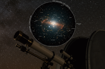
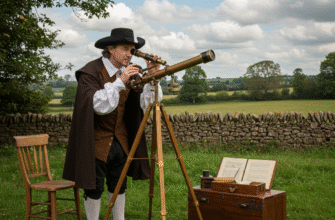
The silent, fathomless expanse of the night sky has captivated humanity since our earliest ancestors first looked upwards. More than just a canvas of twinkling lights, it was a clock, a calendar, and a compass. The desire to understand, to codify, and to map these celestial patterns gave birth to celestial cartography, a discipline that blends art, science, and an enduring sense of wonder. This journey of charting the heavens is a story of evolving technologies, shifting cosmologies, and the relentless human quest for knowledge.
Whispers from Antiquity: The First Star Gazers
The very first celestial maps were likely unrecorded, existing only in oral traditions and the patterns recognised by early sky-watchers. Mesopotamian civilizations, as far back as the Sumerians around 3000 BCE, meticulously observed the movements of stars and planets. They identified constellations, often imbued with mythological significance, and recorded their observations on clay tablets. The famous MUL.APIN tablets, dating to around 1000 BCE, are a compendium of Babylonian astronomical knowledge, listing constellations, stars, and their heliacal risings, essentially forming an early star almanac.
Ancient Egyptians, too, were keen observers. Their understanding of the stars was deeply intertwined with their religion and agricultural practices. They developed star clocks, using groups of stars called decans to tell time at night. While perhaps not maps in the modern sense, these systems represented a sophisticated understanding of stellar positions and movements.
It was the Ancient Greeks, however, who began to formalize celestial cartography with a more scientific approach. Eudoxus of Cnidus, in the 4th century BCE, is credited with describing constellations and proposing a geocentric model of the cosmos with concentric spheres carrying the stars and planets. Though his original works are lost, his descriptions were popularized by Aratus in his didactic poem “Phaenomena,” which became a key reference for constellation imagery for centuries. The true giant of this era was Hipparchus of Nicaea. In the 2nd century BCE, he created a star catalog listing around 850 stars with their celestial coordinates and a magnitude system to describe their brightness. Crucially, Hipparchus is also credited with discovering the precession of the equinoxes, a slow wobble in Earth’s axis that shifts the apparent positions of stars over long periods.
This classical knowledge culminated in the work of Claudius Ptolemy in the 2nd century AD. His “Almagest” (originally “Mathēmatikē Syntaxis”) was a comprehensive treatise on astronomy that included a star catalog of 1,022 stars, arranged into 48 constellations, many of which we still recognize today. Ptolemy provided mathematical models for predicting the movements of celestial bodies, and his work became the undisputed authority in the Western and Islamic worlds for over 1400 years. His maps, though we only have later reconstructions, depicted the constellations as figures, a tradition that would long continue.
The Golden Age of Islamic Astronomy: Preserving and Advancing
As Europe entered the Middle Ages, much of the classical Greek knowledge was preserved and significantly advanced in the Islamic world. Scholars diligently translated Greek texts into Arabic, and observatories, such as the one at Maragha in Persia (13th century), became centers of intense astronomical research. Islamic astronomers were not content to merely copy; they refined instruments, made new observations, and corrected errors in Ptolemy’s data.
A pivotal figure was Abd al-Rahman al-Sufi, a 10th-century Persian astronomer. His “Book of Fixed Stars” (Kitab suwar al-kawakib al-thabita) was a masterpiece. It provided updated positions and magnitudes for Ptolemy’s stars, based on his own observations, and included beautiful illustrations of the constellations, often showing both the classical Greek figure and an Arabic interpretation. Al-Sufi also made the first recorded observation of the Andromeda Galaxy, describing it as a “little cloud.” Ulugh Beg, a 15th-century Timurid ruler and astronomer, established a major observatory in Samarkand and produced the “Zij-i Sultani,” a star catalog of remarkable accuracy for its time, based on fresh observations.
Islamic astronomers made crucial improvements to observational instruments like the astrolabe. These sophisticated devices were used not only for timekeeping and navigation but also for accurately measuring the positions of stars. The meticulous work of scholars like Al-Sufi and Ulugh Beg ensured that celestial knowledge was not only preserved but also significantly refined, paving the way for future advancements.
Their efforts ensured that when astronomical interest reawakened in Europe, there was a rich and improved body of knowledge to draw upon.
Renaissance and the Printed Star: A New Dawn for Sky Maps
The European Renaissance saw a renewed interest in classical learning, and Ptolemy’s “Almagest” was translated from Arabic and Greek into Latin, sparking a resurgence in astronomical study. The invention of the printing press in the mid-15th century was a game-changer for celestial cartography, as it was for all forms of knowledge. Previously, star charts were hand-copied, expensive, and prone to errors. Printing allowed for the mass production of more accurate and affordable maps.
One of the earliest and most famous printed star charts was produced in 1515 by the German artist Albrecht Dürer, along with astronomers Johannes Stabius and Conrad Heinfogel. These were two charts, one for the northern hemisphere and one for the southern, depicting the classical constellations with Dürer’s exquisite artistic skill. While still based on Ptolemy’s data, their wide dissemination set a new standard for celestial atlases.
The Copernican Revolution, initiated by Nicolaus Copernicus’s “De revolutionibus orbium coelestium” (1543), fundamentally shifted the cosmological model from geocentric to heliocentric. While this had profound implications for understanding the universe’s structure, its immediate impact on the *positions* of fixed stars on charts was less direct, as the stars were considered to be on a distant, fixed sphere. However, the intellectual ferment spurred greater observational efforts.
The Telescope’s Gaze: Unveiling a Deeper Sky
The early 17th century brought a technological marvel that would forever change astronomy: the telescope. Though Galileo Galilei did not produce star atlases in the traditional sense, his telescopic observations, published in “Sidereus Nuncius” (1610), revealed that the Milky Way was composed of countless individual stars and that many more stars existed than were visible to the naked eye. This dramatically expanded the known universe and the potential scope of celestial maps.
Johann Bayer’s “Uranometria,” published in 1603 (just before the widespread use of the telescope in astronomy), was a landmark atlas. It cataloged over 1,200 stars based on Tycho Brahe’s exceptionally accurate pre-telescopic observations. Bayer’s great innovation was the system of stellar designation using Greek letters (Alpha, Beta, Gamma, etc.) for the brightest stars in each constellation, a system still in use today. His atlas was also renowned for its artistic depictions of the constellations by Alexander Mair.
Hevelius and Flamsteed: Precision from Observation
Johannes Hevelius, a wealthy brewer and astronomer from Danzig (Gdańsk), was a prominent figure in mid-17th-century celestial cartography. He built his own observatory, equipped with large, meticulously crafted instruments. His “Prodromus Astronomiae” (published posthumously in 1690 by his wife Elisabeth, herself an astronomer) contained a catalog of 1,564 stars, many observed by Hevelius himself. Accompanying this was the “Firmamentum Sobiescianum,” a magnificent star atlas that introduced several new constellations, some of which, like Scutum (the Shield), are still recognized. Hevelius was one of the last major astronomers to rely primarily on naked-eye observations for positional accuracy, even though telescopes were available, as he was skeptical of the distortions in early telescopic optics for precise measurements.
Across the English Channel, John Flamsteed, the first Astronomer Royal at the newly established Greenwich Observatory, embarked on a mission to create an even more accurate star catalog using telescopic sights on his instruments. His monumental “Historia Coelestis Britannica” (1725) and the accompanying “Atlas Coelestis” (1729) listed nearly 3,000 stars with unprecedented precision. Flamsteed’s numbering system for stars within constellations (e.g., 51 Pegasi) is also still widely used where Bayer designations are absent or insufficient. These works set a new benchmark for accuracy and comprehensiveness.
Expanding Horizons: The 18th and 19th Centuries
The 18th and 19th centuries saw continued refinement in instruments and a push towards more systematic and extensive sky surveys. Nicolas Louis de Lacaille traveled to the Cape of Good Hope from 1750-1752 and meticulously cataloged nearly 10,000 southern stars, naming 14 new constellations in the then largely uncharted southern sky, often with names reflecting instruments of science and art (e.g., Fornax the Furnace, Pictor the Painter’s Easel).
William Herschel, with his powerful reflecting telescopes, delved into the structure of the Milky Way and discovered thousands of “nebulae” and star clusters, pushing the boundaries of what celestial maps could represent beyond just individual stars. While he didn’t produce traditional star atlases, his catalogs of deep-sky objects were essential for future mappers.
The monumental effort of Friedrich Wilhelm Argelander and his team at Bonn Observatory in Germany resulted in the “Bonner Durchmusterung” (1859-1862). This catalog, and its accompanying charts, listed the positions and estimated magnitudes of over 324,000 stars in the northern hemisphere down to about 9th magnitude. It was a Herculean task of visual observation and recording, becoming an indispensable resource for astronomers for decades.
Early celestial cartographers faced immense challenges. Without modern technology, they relied on painstaking naked-eye or early telescopic observations, often in difficult conditions. The sheer labor involved in measuring, recording, and then engraving star positions onto plates for printing was enormous. Despite these hurdles, their dedication laid the foundation for our current understanding of the cosmos.
The Photographic Plate and the Digital Cosmos
The advent of astrophotography in the late 19th century revolutionized celestial cartography. Photographic plates could capture fainter stars than the human eye, record positions with greater objectivity and accuracy, and provide a permanent record. Large-scale photographic sky surveys, like the Palomar Observatory Sky Survey (POSS) in the mid-20th century, mapped the sky to much fainter magnitudes and with incredible detail, revealing vast numbers of galaxies and nebulae.
Today, celestial cartography has entered the digital age. Space telescopes like Hubble and, more recently, the Gaia mission, are providing data of unimaginable precision and volume. Gaia, for instance, is measuring the positions, distances, and motions of over a billion stars. This data is no longer primarily disseminated on paper charts but through vast online databases and sophisticated planetarium software that can render dynamic, three-dimensional views of the universe. Users can zoom from a view of the entire celestial sphere down to a faint, distant galaxy with a few clicks.
The journey from ancient clay tablets listing a few dozen stars to digital databases containing billions is a testament to human ingenuity and our unceasing desire to comprehend our place in the universe. Each star chart, whether etched in clay, drawn on parchment, printed on paper, or displayed on a screen, represents a snapshot of our understanding at a particular moment in this grand, ongoing endeavor to map the starry heavens.


