The velvet expanse of the night sky, sprinkled with countless glittering points of light, has captivated human imagination since our earliest ancestors first looked upwards. This cosmic tapestry wasn’t just a source of wonder; it was a practical tool, a calendar, a compass, and a canvas for mythology. To navigate both the physical world and the realm of ideas, humanity felt an innate need to map this celestial sphere, giving rise to the fascinating journey of star charts – a journey from crude scratches on cave walls to the dynamic, data-rich digital universes we can now explore with a few clicks.
Whispers from Antiquity: The First Celestial Maps
Long before the advent of sophisticated instruments, ancient civilizations meticulously observed the heavens. The Babylonians, with their keen mathematical minds, recorded planetary movements and developed early constellation systems, primarily for astrological and calendrical purposes. Egyptian tomb ceilings, like that of Senenmut, depicted recognizable star patterns, intertwining astronomy with their rich religious beliefs. These early “charts” were often more symbolic or artistic than strictly cartographic by modern standards, etched onto stone, painted on papyrus, or woven into oral traditions.
The Greeks, inheriting and expanding upon Babylonian knowledge, made significant strides. Think of Eudoxus of Cnidus, whose lost works described constellations, or Hipparchus, who created one of the first known star catalogs around 129 BCE, noting stellar positions and magnitudes. While his original charts are lost, his data profoundly influenced Claudius Ptolemy. Ptolemy’s Almagest, written in the 2nd century CE, became the cornerstone of Western astronomy for over a millennium. It included a catalog of over a thousand stars, grouped into 48 constellations, many of which we still recognize today. These early efforts, painstakingly hand-drawn and copied, were prone to inaccuracies and variations, yet they represented monumental intellectual achievements, laying the groundwork for centuries of celestial cartography.
The Renaissance of the Skies: Print and Precision
The invention of the printing press in the 15th century was a watershed moment, not just for terrestrial knowledge, but for celestial understanding too. Suddenly, star charts, previously rare and laboriously hand-copied manuscripts, could be reproduced with greater fidelity and distributed far more widely. This democratization of astronomical knowledge fueled further observation and refinement.
As observational techniques improved, even before the telescope’s widespread adoption, star charts began to reflect a greater concern for positional accuracy. This era, marked by the transition from unique manuscripts to reproducible prints, saw the production of stunningly beautiful and increasingly precise celestial atlases. The wider dissemination of astronomical knowledge spurred collaborative efforts and beautifully combined artistic representation with a growing demand for scientific accuracy. Johann Bayer’s Uranometria, published in 1603, was a landmark. It was the first atlas to cover the entire celestial sphere and introduced the system of Bayer designations – using Greek letters (Alpha, Beta, Gamma, etc.) to denote the brightest stars within each constellation, a system still in use. The illustrations in Uranometria, often elaborate and artistic, depicted the mythological figures associated with the constellations, truly blending art with emerging science.
Later, John Flamsteed, the first Astronomer Royal in England, produced his Atlas Coelestis, published posthumously in 1729. Based on extensive telescopic observations from the Royal Observatory, Greenwich, it offered unprecedented accuracy for its time. While these printed charts were a massive leap forward, they still relied on manual engraving of copper plates, a meticulous and skilled process. The artistry remained, but the scientific imperative for precision was becoming paramount.
Capturing Light: The Photographic Revolution
The 19th century introduced a technology that would once again revolutionize how we map the stars: photography. The ability to capture faint celestial objects directly onto a photographic plate offered a level of objectivity and detail previously unimaginable. Early astronomical photography was challenging, requiring long exposures and painstaking chemical processes, but its potential was immediately apparent.
Pioneers like Warren De La Rue and Henry Draper demonstrated the power of astrophotography. Instead of relying on the observer’s eye and hand to record positions and magnitudes, the photographic plate became an impartial witness. This led to ambitious projects, most notably the Carte du Ciel (Map of the Sky), an international endeavor initiated in the late 19th century. Its goal was to photograph the entire sky and produce a comprehensive star catalog. While the project was never fully completed as envisioned due to its immense scale and the evolving nature of astronomical techniques, it produced a vast archive of photographic plates that were invaluable for decades.
Photographic sky surveys, like the Palomar Observatory Sky Survey (POSS I and later POSS II), became the gold standard. These surveys used powerful Schmidt telescopes to capture deep, wide-field images of the night sky on large photographic plates. These plates could then be meticulously scanned and analyzed to create detailed atlases and catalogs, revealing fainter and more distant objects than ever before. The era of the photographic plate provided a tangible, archivable record of the sky at specific epochs, crucial for studying stellar proper motions and variable objects.
The Digital Frontier: Pixels and Databases
The latter half of the 20th century witnessed the rise of computers, and with them, the dawn of digital star charts. The ability to store, process, and display vast amounts of astronomical data digitally transformed celestial cartography from a static, two-dimensional representation into a dynamic, interactive experience.
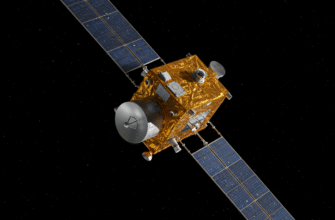
Early digital star catalogs, such as the Smithsonian Astrophysical Observatory Star Catalog (SAO Catalog), compiled data from various sources into machine-readable formats. The real game-changer, however, was the development of dedicated space missions for astrometry, like the European Space Agency’s Hipparcos satellite, launched in 1989. Hipparcos measured the positions, parallaxes, and proper motions of over a hundred thousand stars with unprecedented accuracy, providing a foundational dataset for a new generation of digital charts.
Planetarium software for personal computers began to emerge, programs like SkyMap or TheSky, allowing amateur and professional astronomers alike to generate custom star charts for any location, date, and time. These programs could display stars, deep-sky objects, planets, and comets, often overlaying constellation lines and artwork. The advantages were manifold: instant chart generation, the ability to zoom in and out, filter objects by magnitude or type, and simulate celestial events. The static, printed page was giving way to an interactive celestial canvas.
The Cosmos at Your Fingertips: Modern Surveys and Virtual Observatories
Today, we are immersed in an era of colossal digital sky surveys. Projects like the Sloan Digital Sky Survey (SDSS), Pan-STARRS, and the Gaia mission are mapping the sky with incredible depth and precision, not just in visible light but across multiple wavelengths of the electromagnetic spectrum. Gaia, in particular, is revolutionizing astrometry, providing positions, parallaxes, and proper motions for over a billion stars, creating a truly three-dimensional map of a significant portion of our Milky Way galaxy.
These surveys generate petabytes of data, far too much for traditional printed atlases. Instead, the data fuels sophisticated online digital sky atlases and virtual observatories. Platforms like Aladin Sky Atlas, Stellarium (a free, open-source planetarium), and various NASA/ESA data archives allow anyone with an internet connection to explore these vast datasets. You can seamlessly pan across the sky, zoom into distant galaxies, overlay data from different surveys, and even access detailed information about individual objects with a click.
Digital star charts and virtual observatories have democratized access to astronomical data on an unprecedented scale. While incredibly powerful, users should be aware that data from different surveys may have varying levels of accuracy, completeness, or calibration. Always check the source and documentation when conducting detailed research or relying on precise values for specific applications.
The modern digital star chart is no longer just a map; it’s an interactive research tool. It can be linked directly to telescope control systems, allowing observers to point their instruments with pinpoint accuracy. Citizen science projects leverage these digital platforms, enabling enthusiasts to contribute to real astronomical discoveries, such as classifying galaxies or identifying new celestial phenomena. The evolution has brought us from static representations of what was known to dynamic explorations of an ever-expanding cosmic database.
An Ever-Evolving View
The journey of the star chart, from ancient hand-drawn sketches to the sprawling digital universes of today, mirrors humanity’s own evolving understanding of the cosmos. Each technological leap – from the printing press to photography to the digital computer – has unlocked new layers of celestial detail and new ways of perceiving our place within it. What began as a tool for navigation and a canvas for myth has become a dynamic interface to the universe itself. The quest to map the heavens is far from over; as our instruments become more sensitive and our reach extends further, our celestial atlases will continue to evolve, offering ever more breathtaking and insightful views of the grand cosmic ocean.

