The vast, shimmering expanse of the Mediterranean, and indeed the wilder Atlantic beyond, was once the undisputed highway of the Phoenicians. These master mariners, hailing from bustling city-states like Tyre, Sidon, and Byblos, didn’t just hug coastlines; they dared to strike out across open water, their distinctive biremes laden with precious cargoes of cedarwood, purple dye, glass, and metals. What was their secret? In an age devoid of compasses, GPS, or even detailed charts as we know them, their eyes were fixed on the heavens. The sun, moon, and stars were their map, their clock, and their most steadfast companions.
The Unseen Hand Guiding the Keel
For the Phoenicians, successful navigation wasn’t merely a skill; it was the lifeblood of their civilization. Their far-flung trading networks and colonial ambitions, stretching from the Levant to the Iberian Peninsula and possibly even further, demanded an unparalleled ability to find their way across trackless seas. Imagine setting sail from Tyre, aiming for the tin mines of distant Cornwall or the rich fishing grounds off the coast of what is now Morocco. Landfall was uncertain, storms were a constant threat, and a single miscalculation could spell disaster. It was this high-stakes environment that honed their celestial navigation skills to a legendary edge. They weren’t just sailors; they were practical astronomers, their ships serving as floating observatories.
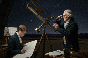
Their understanding of the sky was born from generations of keen observation, passed down from master to apprentice, whispered on watch during the long, dark nights at sea. This knowledge was a closely guarded secret, a competitive advantage in the cutthroat world of ancient trade. While their neighbors might have looked to the stars with awe or trepidation, the Phoenicians saw patterns, pathways, and promises of safe passage.
Reading the Celestial Script
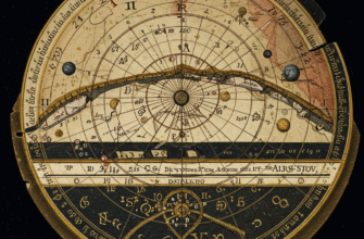
The Phoenician mariner’s toolkit was deceptively simple, relying on the most ancient of instruments: the human eye, guided by a profound understanding of celestial mechanics. They learned to read the sky like a grand, ever-shifting manuscript, each celestial body offering its own unique clues.
The Sun: A Fiery Signpost
By day, the sun was their primary guide. Its daily arc across the sky provided a clear indication of east and west. At noon, when the sun reached its zenith, the shortest shadow cast by the mast or any vertical object would point directly north (in the northern hemisphere). Phoenician sailors likely developed methods to estimate latitude by observing the sun’s height at noon. While they lacked precise instruments like the sextant, they could have used simple techniques, perhaps noting the length of the noon shadow relative to a fixed point on deck, or even using hand-widths to gauge the sun’s altitude above the horizon. Regular observation at known ports would have allowed them to build up a mental database, correlating shadow lengths or sun heights with specific latitudes, enabling them to sail along a line of latitude with a surprising degree of accuracy.
The Moon: Night’s Gentle Luminary
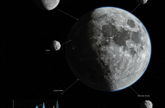
When darkness fell, if the stars were obscured by haze or thin cloud, the moon offered another celestial reference. Its phases, from new to full and back again, provided a natural calendar, crucial for planning long voyages and anticipating seasonal changes. While not as fixed as the stars for directional purposes, the moon’s position and path across the sky still offered general directional cues, especially when its position relative to familiar constellations could be discerned. On a clear night with a bright moon, it could also illuminate the sea, making sailing less hazardous.
The Phoenician Star: Their Unwavering Beacon
The true secret weapon in the Phoenician navigational arsenal, however, was their mastery of the northern stars. While many ancient cultures navigated by the stars, the Phoenicians were particularly renowned for their use of a star that lay very close to the true celestial north pole. The Greeks, in fact, referred to the constellation Ursa Minor (the Little Bear or Little Dipper) as the “Phoenikē” or “Phoenician Star,” a testament to its importance in Phoenician navigation. The star we now call Polaris, or the North Star, is part of Ursa Minor and is currently very close to the north celestial pole. In Phoenician times, another star in Ursa Minor, Kochab, was a better pole star than Polaris is now, but the Phoenicians seem to have focused on the constellation as a whole, or perhaps a star within it that was even closer to the pole than the one the Greeks favored (likely a dimmer star closer to the true pole than Kochab, which the Greeks primarily used within Ursa Minor, or they were more adept at using the entire constellation to pinpoint north).
This “Phoenician Star” provided a fixed point in the northern sky around which all other stars appeared to revolve. By keeping this star at a consistent bearing relative to their ship – off the starboard bow, for instance – they could maintain a steady course. This was far more accurate than relying on Ursa Major (the Great Bear or Big Dipper), which, while prominent, circles at a greater distance from the celestial pole and is therefore less precise for determining true north throughout the night. This meticulous focus on the most accurate northern guide available set them apart.
The ancient Greeks, themselves skilled seafarers, openly acknowledged the Phoenicians’ superior technique in using Ursa Minor for navigation. Writers like Aratus mentioned that Greek sailors tended to use the larger, more obvious Helikē (Ursa Major), while Phoenician mariners trusted the “lesser but more reliable” Kynosoura (Ursa Minor) because it described a smaller circle around the pole, thus offering a more constant indication of north. This distinction highlights the Phoenicians’ advanced observational skills and their practical, results-driven approach to celestial navigation.
A Tapestry of Constellations
Beyond the Pole Star, other constellations served as wayfinders and seasonal markers. The rising and setting of specific star groups at certain times of year would signal the changing seasons, important for knowing when favorable winds might blow or when dangerous storm seasons approached. Familiar patterns of stars would have helped them orient themselves and even, perhaps, estimate their east-west position (longitude) very roughly, through observing which stars were culminating at midnight, a far more complex task than determining latitude. They understood that as they sailed east or west, the familiar stars would appear to rise and set earlier or later, respectively. This subtle shift, observed over many nights, could give a seasoned navigator a sense of their longitudinal progress.
Whispers on the Wind, Clues in the Deep
While the stars were paramount, it’s almost certain the Phoenicians supplemented their celestial knowledge with other natural cues. The patterns of prevailing winds, the direction of ocean swells and currents, the flight paths of migratory birds, and even the color and temperature of the water could all offer subtle hints to an experienced mariner. They might have noticed how certain types of seaweed only grew near land, or how the behavior of marine life changed as they approached different coasts. These terrestrial signs, combined with their unparalleled understanding of the night sky, created a comprehensive navigational system that was both resilient and remarkably effective for its time.
Piecing Together a Lost Art
Frustratingly, the Phoenicians themselves left few written records detailing their navigational techniques. Much of their knowledge was practical, passed down orally, and likely kept secret to protect their trade advantages. Our understanding is therefore pieced together from several sources:
- Accounts from other cultures: Greek and Roman writers, such as Herodotus, Strabo, and Pliny the Elder, described Phoenician seafaring prowess, sometimes with awe, sometimes with envy. These texts provide invaluable, if sometimes indirect, clues.
- Archaeology: The discovery of Phoenician shipwrecks, their cargoes, and trading posts spread across the Mediterranean and beyond provides physical evidence of the vast distances they traveled. The locations of these finds map out their routes and testify to their ability to reach precise destinations.
- Logical Inference: By understanding the astronomical knowledge available in the ancient world and the practical challenges of long-distance sea travel, historians can infer many of the methods the Phoenicians must have used.
The very fact that they could establish and maintain such a widespread network of trade and colonies for centuries is perhaps the most compelling evidence of their navigational genius. Their voyages were not lucky accidents; they were the result of systematic knowledge and application.
A Legacy Etched in Starlight
The celestial navigation secrets of the ancient Phoenicians were more than just a means to an end; they were a foundational element of Western maritime tradition. Their techniques, refined through centuries of voyages, undoubtedly influenced later seafaring cultures, including the Greeks and Romans, who built upon this inherited knowledge. The courage to sail out of sight of land, trusting in the silent guidance of the stars, was a monumental step in human history, opening up the world to exploration, trade, and cultural exchange.
Though the Phoenicians themselves have long since faded into history, their legacy as fearless innovators of the sea endures. Every time we look up at the night sky and ponder our place in the cosmos, we echo, in some small way, the gaze of those ancient mariners who found their path across the dark waters by reading the secrets written in starlight. Their ships may be gone, their logs lost, but the stars they navigated by still shine down, silent witnesses to their incredible journeys.

