Imagine an ocean, not of water, but of endless, rolling sand, stretching further than the eye can comprehend. Under a sun that beats down with relentless intensity, or a night sky so clear it feels you could touch the cosmos, the desert presents a formidable challenge to any traveler. Yet, for centuries, the Bedouin people have not just survived but thrived in these seemingly inhospitable landscapes. Their secret lies not in advanced technology, but in an intimate, profound understanding of the natural world – a knowledge system passed down through generations, where the stars, the wind, and even the subtlest shifts in the sand become trusted guides.
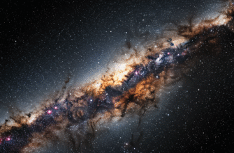
When darkness drapes the desert, a breathtaking panorama unfolds above. Free from the light pollution that veils the heavens in urban areas, the desert sky becomes a vibrant, living map. For the Bedouin, this celestial display was their primary compass, their calendar, and their storyteller.
Reading the Night Sky
Navigating by stars in the desert is an art honed over millennia. In an environment where landmarks are scarce or can shift with the winds, the predictable movements of celestial bodies offered unwavering certainty. Bedouins developed an encyclopedic knowledge of the stars, their paths, and their seasonal appearances.
The North Star (Al-Qutb): The undisputed king of celestial navigation is Polaris, known in Arabic as “Al-Qutb” (the Pole or Axis). Its unique position, appearing almost stationary in the northern sky while other stars revolve around it, makes it the most reliable indicator of true north. By locating Al-Qutb, a Bedouin traveler could orient themselves instantly, no matter the time of night. The height of Al-Qutb above the horizon also provided a rough estimate of their latitude, a crucial piece of information for long journeys.
Ursa Major (Ad-Dubb al-Akbar): The Great Bear, or “Ad-Dubb al-Akbar” (The Greater Bear) in Arabic, is another vital constellation. Its two “pointer” stars at the edge of the dipper’s bowl always point towards Polaris, making Al-Qutb easier to find. Bedouins would also observe the rotation of Ad-Dubb al-Akbar around Polaris throughout the night to gauge the passage of time.
Orion (Al-Jabbar): The mighty constellation of Orion, “Al-Jabbar” (The Giant), is a prominent winter constellation in the Northern Hemisphere. Its distinctive three-star belt rises in the east and sets in the west, providing a clear directional cue. The appearance of Al-Jabbar also signaled changes in seasons, an important consideration for nomadic life and the availability of pasture and water.
The Pleiades (Al-Thurayya): This beautiful star cluster, known as “Al-Thurayya,” held immense significance. Its heliacal rising (first appearance before sunrise) often marked the beginning of specific seasons, sometimes associated with the onset of rains or cooler weather. Its position in the sky at different times of the night also aided in navigation and timekeeping. The saying “If Thurayya rises in the evening, the herdsman seeks a thicker garment; if it rises at dawn, he seeks a shady spot” reflects its seasonal importance.
Canopus (Suhail): A brilliant star visible in the southern sky, Canopus, or “Suhail” in Arabic, was another key navigational aid, particularly for those traveling southwards or in regions where it was prominently visible. Like Al-Thurayya, its appearance heralded seasonal changes and was eagerly anticipated. It often signaled the end of the worst summer heat.
Bedouin navigators didn’t just identify individual stars; they understood their interrelationships and apparent movements. They knew which stars rose before others, which ones culminated at midnight during certain seasons, and how their positions changed with the passing hours. This dynamic understanding transformed the night sky into a reliable clock and compass, essential for timing journeys and maintaining direction through the darkest nights.
Beyond Individual Stars: Celestial Narratives
The Bedouin understanding of the heavens was often woven into rich oral traditions, stories, and poems. Constellations were not mere patterns of light but characters in grand celestial dramas. These narratives served a practical purpose: they made the complex movements and identities of stars easier to remember and pass down. A story about a celestial hunter chasing a group of sisters (like the Pleiades) is far more memorable than a dry list of star names and positions. This personification of the cosmos made the sky a familiar, relatable landscape, a companion on long, solitary journeys. The stars were friends, guides, and storytellers, their light cutting through the profound darkness of the desert night.
The Sun’s Unwavering Path
While the stars ruled the night, the sun governed the day. Bedouin navigators possessed an equally sophisticated understanding of solar navigation and the subtle clues offered by the desert landscape itself.
The sun’s daily journey across the sky provided fundamental directional information. Sunrise, of course, indicated east, and sunset marked west. The crucial moment, however, was often midday. By observing the shortest shadow cast by a vertical object (or even their own body), Bedouins could determine true south (in the Northern Hemisphere) and, by extension, all other cardinal directions. This required keen observation, as the shadow’s length and direction change constantly. They also learned to estimate the time of day by the sun’s altitude and the length of shadows, crucial for pacing journeys and reaching water sources before nightfall or the peak of midday heat.
However, daytime navigation using the sun had its challenges. The intense glare could be disorienting, and during the middle of the day, when the sun is high overhead, shadows become very short and less distinct. Heat haze could also distort distant features, making visual landmark navigation unreliable if not impossible at times.
Whispers of the Wind and Shifting Sands
The desert is a realm sculpted by wind. Bedouins learned to read the wind as expertly as they read the stars. Prevailing wind directions, often consistent for long periods, would shape sand dunes into recognizable patterns. Different types of dunes – barchans (crescent-shaped), seifs (longitudinal), or star dunes – form under specific wind regimes and can indicate general directions. For instance, the horns of a barchan dune typically point downwind.
The texture of the sand itself could offer clues. Wind-blown sand creates ripples, and the orientation and coarseness of these ripples can indicate the prevailing wind direction. More experienced navigators could even feel the direction of the wind on their faces or observe the lean of sparse desert vegetation, which often grows in a way that minimizes wind resistance. They developed a sensitivity to the subtle language of the land, noticing minute details that an untrained eye would completely overlook. The direction from which the coolest breeze came in the morning, or the side of a rock that felt damp with dew, could all be part of the navigational puzzle.
Relying solely on dune formations for direction requires extreme caution and deep local knowledge. Dune fields can be vast and complex, with localized wind patterns creating confusing variations. Moreover, strong storms can reshape dunes, altering familiar landscapes overnight. The truly skilled Bedouin navigator cross-referenced these signs with other indicators, never trusting a single clue in isolation when survival was at stake.
The Living Desert’s Clues
Beyond the grand canvases of sky and sand, the desert is alive with smaller, more subtle indicators that a seasoned Bedouin navigator would integrate into their wayfinding.
While seemingly barren, the desert supports a surprising amount of life, and this life often adheres to patterns that can aid navigation. Certain species of plants, for example, might thrive only on slopes facing a particular direction, seeking more sunlight or protection from harsh winds. The slight lean of hardy desert shrubs, sculpted by prevailing winds over time, could also provide a directional hint. Observing the density and type of vegetation could indicate proximity to underground water sources or wadis (dry riverbeds) that served as natural pathways.
Animal behavior provided another layer of information. The tracks of animals might lead towards waterholes. Migratory birds, following ancient routes, fly in predictable directions at certain times of the year. Even the calls of specific birds or animals, heard from a distance, could signal the presence of an oasis or a particular type of terrain. The Bedouin lived in such close harmony with their environment that these subtle signs were as legible to them as street signs are to an urban dweller. Sounds, too, played a role; the way sound traveled could indicate changes in terrain or atmospheric conditions. The distant barking of dogs could signal a camp, or a specific echo might denote a familiar cliff face.
A Deeply Ingrained Skill
The incredible navigational skills of the Bedouin were not solely reliant on knowledge of stars or sand; they were deeply rooted in a particular way of seeing, remembering, and interacting with the world.
From a very young age, Bedouin children were immersed in the desert environment. They learned to observe, to listen, and to pay attention to the minute details that could mean the difference between safety and peril. This was not formal schooling in a classroom, but a practical, experiential education. Navigation was not an abstract subject but an essential life skill, absorbed through participation in daily life, accompanying elders on journeys, and listening to stories and teachings.
The oral tradition was paramount. Vast amounts of geographical and navigational knowledge – locations of wells, characteristics of different routes, seasonal changes, star patterns – were preserved and transmitted through poems, songs, and spoken accounts. A navigator’s mind became a repository of detailed mental maps, meticulously constructed and updated through experience. They could visualize vast stretches of desert, recalling subtle landmarks, the texture of the ground in a particular area, or the unique silhouette of a distant mountain range seen from a specific vantage point. This cognitive mapping ability was, and is, extraordinary.
Patience and intuition were also key. Desert travel is often slow and deliberate. A Bedouin navigator would patiently observe, cross-referencing multiple signs before making a decision. Intuition, born from years of experience and a deep connection to the environment, often guided them when explicit signs were scarce or ambiguous. It was a holistic understanding, where logic and a “feel” for the land worked in tandem.
Tradition Meets Technology
The advent of modern technology, particularly Global Positioning Systems (GPS), has undoubtedly brought changes to the way people navigate the desert, including among Bedouin communities.
GPS devices offer precise location data at the touch of a button, a stark contrast to the nuanced, observation-based methods of traditional wayfinding. Many Bedouins today utilize GPS for its convenience and accuracy, especially for long or unfamiliar routes. However, this does not mean that traditional knowledge has become obsolete. Far from it.
Technology can fail. Batteries die, devices break, signals can be lost. In such situations, the age-old skills of reading the stars, the sun, and the land become invaluable, a reliable backup that has proven its worth over centuries. Furthermore, traditional knowledge encompasses more than just direction finding; it includes understanding weather patterns, locating water and pasture, knowing medicinal plants, and a deep ecological wisdom that technology alone cannot provide.
There is a growing recognition, both within Bedouin communities and among outsiders, of the importance of preserving this rich heritage. Efforts are being made to document traditional navigational techniques, star lore, and environmental knowledge. Younger generations are sometimes less exposed to these skills as lifestyles change, making preservation efforts even more critical. The wisdom of the desert navigator is a testament to human ingenuity and our capacity to live in harmony with even the most challenging environments.
The Bedouin wayfinder, gazing at the star-dusted heavens or scanning the subtle contours of a dune, embodies a profound connection to the earth and sky. Their methods are a beautiful blend of scientific observation and intuitive artistry, a system of knowledge as vast and intricate as the desert itself. In an age increasingly dominated by screens and detached from the natural world, their legacy reminds us of the power of keen observation, the importance of passed-down wisdom, and the deep, enduring secrets the natural world holds for those who know how to look and listen.

