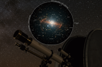
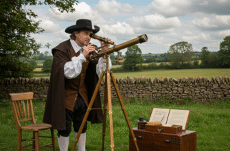
Imagine the scene: a tiny vessel, a mere speck on an endless, rolling ocean. Land is a distant memory, perhaps not even a certainty. Above, an ink-black sky blazes with a million points of light. This was the world of the ancient navigator, a world where survival and discovery depended not on sophisticated electronics, but on an intimate, hard-won knowledge of the heavens. Long before the invention of the magnetic compass or the precise angles of the sextant, mariners dared to cross vast stretches of water, guided by the silent, predictable dance of the stars.
It’s a staggering thought. How did they orient themselves? How did they maintain a course, or find their way back to unseen shores? The answer lies in meticulous observation, generational wisdom, and a profound connection to the natural world. The sky, particularly at night, was their most reliable map and clock.
The Sun: Day’s Guiding Hand
Before the stars took their nightly stage, the Sun was the primary celestial guide. Its daily journey from east to west was the most fundamental directional clue. An ancient mariner knew that if they kept the rising sun to their port (left) side in the morning, they were generally heading south, and if it was to their starboard (right), they were heading north. This was, of course, a rough guide, influenced by the time of year, but it was a start.
More sophisticated observations involved the Sun’s meridian passage – the moment it reached its highest point in the sky, indicating local noon. At this point, the Sun would be due north or south depending on the observer’s latitude and the time of year. By noting the Sun’s altitude at noon, experienced navigators could get a rough estimate of their latitude, their north-south position. This required an understanding of the Sun’s seasonal changes in declination (its height above the celestial equator). For instance, they knew the sun would be lower in the sky at noon during winter months and higher during summer months when in the Northern Hemisphere. Simple tools, like a marked stick or even hand-widths held at arm’s length, could be used to make these rudimentary altitude measurements. It wasn’t precise, but it was far better than nothing.
When Darkness Fell: The Star-Studded Compass
As dusk yielded to night, the true majesty of the ancient navigator’s toolkit revealed itself. The stars, unlike the wandering planets, hold relatively fixed positions in relation to each other, forming patterns that have been recognized and named by cultures across the globe for millennia. This predictability was the key.
Polaris: The Northern Hemisphere’s Lode Star
For those sailing the northern seas, one star reigned supreme: Polaris, the North Star. What makes Polaris so special is its proximity to the North Celestial Pole, the point in the sky around which all other stars in the Northern Hemisphere appear to rotate due to the Earth’s spin. Polaris, therefore, seems to hang almost motionless, a steadfast beacon marking true north. Fog or clouds obscuring Polaris were a mariner’s dread.
Finding Polaris was a crucial skill. The most common method involved locating the prominent constellation Ursa Major, often called the Big Dipper. The two stars forming the outer edge of the Dipper’s “bowl” (Dubhe and Merak) are known as “the Pointers.” An imaginary line drawn through these stars and extended upwards about five times the distance between them leads directly to Polaris. Another guide was Cassiopeia, a W-shaped constellation, which lies on the opposite side of Polaris from the Big Dipper. If one was low, the other was high.
Crucially, the altitude of Polaris above the horizon is almost exactly equal to the observer’s latitude. If Polaris appeared, say, 30 degrees above the horizon, the navigator knew they were at approximately 30 degrees North latitude. Measurement could be done using fingers or hands held at arm’s length – a fist might represent about 10 degrees, a finger-width about 1.5 to 2 degrees. These “hand rules” were surprisingly effective with practice.
Guiding Lights of the South: The Southern Cross
Sailors in the Southern Hemisphere lacked a single, bright pole star like Polaris. However, they had their own celestial guides. The most famous is the constellation Crux, commonly known as the Southern Cross. This compact, cross-shaped asterism, while not directly marking the South Celestial Pole, provides a reliable way to find it.
To locate south using Crux, navigators would extend an imaginary line through the long axis of the cross, about four and a half times its length. Separately, they would find two other bright stars, Alpha Centauri and Beta Centauri (often called “The Pointers” to the Southern Cross). A perpendicular line drawn from the midpoint of the line connecting these two Pointers would intersect the line extended from Crux at a point very close to the South Celestial Pole. From this celestial pole, dropping a line straight down to the horizon indicated true south. Other constellations, like Achernar, were also used in conjunction with Crux or as alternative pointers depending on their visibility and the time of night.
Constellations as Celestial Signposts
Beyond pole stars, the entire tapestry of constellations served as a dynamic map. Ancient mariners possessed an encyclopedic knowledge of these star patterns, their rising and setting points, and their seasonal visibility. Just as the Sun rises in the east and sets in the west, so too do the stars and constellations, wheeling across the sky throughout the night.
Specific constellations became associated with particular directions at certain times of the year or night. For example, a navigator might know that when Orion’s Belt rose directly in the east, following it would keep them on an eastward course. As the night progressed and Orion climbed higher and then began to set in the west, its utility as an easterly marker would change, but its position relative to other stars remained constant, allowing for continuous orientation.
Seasonal constellations were also vital. The appearance of certain star groups on the eastern horizon at sunset, or their position high in the sky at midnight, could tell an experienced sky-watcher the time of year, which was crucial for anticipating weather patterns, currents, and even for estimating progress on long voyages. For instance, the summer triangle (Vega, Deneb, Altair) dominating the summer sky in the Northern Hemisphere, or Scorpio heralding warmer months, were familiar friends.
Another advanced technique involved “zenith stars.” If a navigator knew that a particular bright star passed directly overhead (at its zenith) at their home port or a known island, they could sail north or south until that same star passed directly overhead again. This would mean they had reached the same latitude as their target. This required very precise observation and knowledge of star positions.
The Art of Reading the Heavens: Techniques and Knowledge
This celestial knowledge wasn’t casually acquired; it was a deeply ingrained skill, often passed down through generations via oral traditions, chants, and stories. Young apprentices would spend years learning the star paths, the subtle shifts of constellations with the seasons, and the intricate relationships between different celestial bodies.
The Polynesians, renowned as some of the greatest ancient navigators, developed sophisticated systems. They memorized the rising and setting points of hundreds of stars. Their “star compass” wasn’t a physical device but a mental construct, dividing the horizon into as many as 32 points, each marked by the rising or setting position of a specific star. They also created remarkable “stick charts,” which were not literal maps of the stars, but rather mnemonic devices representing ocean swell patterns, prevailing winds, and the relative locations of islands, often with curved sticks indicating how to use stars to steer towards them.
Ancient Polynesian navigators, known as wayfinders, developed sophisticated star maps called “stick charts.” These charts didn’t map stars literally but represented ocean swell patterns, island locations, and the stars used to steer between them. Their accuracy allowed for intentional voyages across vast stretches of the Pacific Ocean, a testament to their profound understanding of the natural world. This knowledge was often kept secret within families or guilds of navigators.
Similarly, the Vikings, who navigated the challenging North Atlantic, relied on the Sun, Polaris, and other constellations. Their sagas contain detailed descriptions of coastlines and sailing directions, which often included references to celestial bodies and natural phenomena. They understood how the sun’s path changed with the seasons and latitudes, using simple sun-stones (thought to be polarizing crystals like cordierite) to locate the sun’s position even on overcast days.
Beyond the Stars: Nature’s Other Clues
While stars were paramount, ancient navigators were holistic observers, using a suite of natural cues to complement their celestial readings. These were especially vital when clouds obscured the sky:
- Ocean Swells: Consistent wave patterns, often generated by distant storms or prevailing winds, could indicate a general direction even when land was not visible. Skilled navigators could detect subtle changes in swell patterns as they approached islands, which would refract or block the waves. * Wind Patterns: Knowledge of prevailing winds, like the trade winds, was essential for planning routes and maintaining course.
- Bird Migrations: The flight paths of migratory birds often pointed towards land. The type of bird and its behavior could also offer clues.
- Water Color and Temperature: Changes in water color or temperature could sometimes indicate proximity to land, currents, or different water masses, though these were less reliable in the deep ocean.
- Floating Debris and Clouds: The sight of land-based vegetation or fixed cloud formations on the horizon could signal an island nearby.
The Unseen Challenge: Longitude
While ancient navigators became remarkably adept at determining latitude (their north-south position) using the stars and Sun, determining longitude (their east-west position) was a far greater challenge. Longitude is fundamentally linked to time. To know your longitude, you need to know the time at a reference meridian (like Greenwich today) and compare it to your local time, which can be found from the Sun or stars. Without accurate chronometers, which wouldn’t be developed until the 18th century, precise longitude measurement was impossible.
Ancient mariners relied primarily on “dead reckoning” for longitude. This involved estimating their speed and direction sailed from a known point, factoring in currents and leeway (sideways drift). They would combine this with their latitude sightings. For example, they might sail north or south to reach the correct latitude of their destination, and then sail east or west along that latitude line, hoping to make landfall. This was fraught with uncertainty. They could make educated guesses by observing the timing of star risings or settings compared to when they might occur at their home port, but this was very approximate and prone to significant error over long distances.
A Legacy Etched in the Skies
The achievements of these early star-gazers are nothing short of heroic. Their ability to read the heavens, to transform the night sky into a functional map and compass, allowed for the exploration and settlement of vast regions of our planet. They faced incredible dangers – storms, getting lost, starvation – with a courage born of necessity and deep-seated knowledge.
This ancient wisdom, the art of celestial navigation, formed the bedrock upon which all later navigational advancements were built. The magnetic compass, the astrolabe, the quadrant, and eventually the sextant and chronometer, all sought to refine and make more precise the fundamental principles understood by these early masters of the sea and sky. Their legacy is a powerful reminder of human ingenuity and our timeless connection to the cosmos, a connection that guided our ancestors across Earth’s final frontiers.


