Imagine an ocean so vast it dwarfs continents, a liquid wilderness stretching for thousands of miles, dotted with islands so small they are mere specks on the grand blue canvas. Now, picture navigating this expanse not with GPS, sextants, or compasses, but with the wisdom of your ancestors, the guidance of the stars, the feel of the waves beneath your canoe, and the stories whispered on the wind. This was the world of Polynesian wayfinders, master navigators who, for millennia, explored and settled the Pacific Ocean, undertaking some of the most remarkable voyages in human history. Their methods were a testament to human ingenuity and a profound, intimate connection with the natural world.
The Great Blue Highway
The Pacific Ocean, the “Great Blue Highway” as some call it, presented an immense challenge. Unlike coastal navigation, where land is often in sight, Polynesian voyagers sailed into the unknown, often for weeks or months at a time, searching for islands they knew existed only through legend or the faintest of environmental clues. Their vessels, magnificent double-hulled canoes or “vaka” (also “waʻa” in Hawaiian), were masterpieces of design, capable of carrying people, plants, animals, and supplies across incredible distances. But the canoe was only half the equation; the other half was the navigator, the “pwo” or “palu,” a figure of immense knowledge and respect.
These navigators didn’t just point their canoes in a general direction and hope for the best. They carried a detailed mental map of the ocean, a map not drawn on paper but encoded in their memory, in chants, and in their understanding of natural phenomena. They were, in essence, living computers, processing a constant stream of environmental data to determine their position and course.
Reading Nature’s Compass
The toolkit of the Polynesian wayfinder was entirely natural, relying on senses honed to an extraordinary degree and a deep understanding of predictable patterns in the environment.
The Starry Path
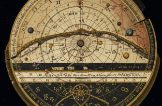
At night, the heavens provided the primary directional guide. Navigators memorized the rising and setting points of hundreds of stars. They envisioned a “star compass,” a conceptual circle around the canoe, with specific stars marking different bearings as they rose from or set into the ocean horizon. Knowing the sequence of these stars throughout the night allowed them to maintain a consistent heading. Zenith stars, those passing directly overhead, were crucial for determining latitude. If a particular star was known to pass directly over a target island, the navigator would sail north or south until that star was at its zenith at its meridian passage, then turn east or west along that line of latitude.
The Sun’s Daily Journey
During the day, the sun was the main reference. Its rising and setting points, while shifting throughout the year, were predictable. The navigator also observed the sun’s arc across the sky, its height at noon, and the subtle changes in light and shadow to maintain their orientation. The glare of the sun on the water, the color of the sky at dawn and dusk – all were subtle clues.
Whispers of the Waves
Perhaps one of the most sophisticated and subtle aspects of Polynesian wayfinding was the interpretation of ocean swells and waves. Long-distance ocean swells, generated by distant storms, travel in consistent directions for thousands of miles. A skilled navigator could feel these swells through the hull of the canoe, even in their sleep. They learned to distinguish between different types of swells – the dominant swell, secondary swells, and crucially, swells reflected or refracted by islands. As a canoe approached an island, even one still below the horizon, the pattern of ocean swells would change. Land would block, reflect, or bend these swells, creating a “wave shadow” or a distinct interference pattern that a trained navigator could detect, literally feeling the presence of land long before it could be seen.
Polynesian wayfinding was a holistic science, integrating observations of celestial bodies, oceanographic phenomena like swells, and meteorological patterns. Navigators underwent years of rigorous training, memorizing vast amounts of information passed down through oral traditions. This system allowed them to consistently locate small island targets across immense stretches of open ocean, a feat that relied entirely on their knowledge and senses, without any instrumentation.
Wind and Weather Wisdom
Winds were, of course, critical for propulsion but also for navigation. Navigators understood prevailing wind patterns, seasonal shifts (like trade winds), and how these interacted with island topography. They could read the clouds: certain types of cumulus clouds, for example, tend to form over islands due to the rising warm, moist air. The color of the clouds and the behavior of the wind around them could also hint at the proximity of land.
Nature’s Signposts: Birds and Marine Life
The behavior of wildlife provided further clues, especially when land was thought to be near. Land-based seabirds, such as noddies and terns, have a limited foraging range. Seeing these birds flying out in the morning and returning towards land in the evening could guide a canoe to an unseen island. The type of bird, its flight path, and the time of day were all important indicators. Similarly, certain types of fish, floating debris, or even the scent of vegetation carried on the wind could signal that land was not far off.
The Knowledge Keepers
This intricate knowledge was not written down in books but passed from master to apprentice through generations, often within specific families. It was embedded in lengthy chants, epic poems, and stories that detailed voyages, star paths, island locations, and the characteristics of ocean swells. These oral traditions were not mere folklore; they were precise navigational databases, memorized and recited with incredible accuracy. The training of a wayfinder was arduous, beginning in childhood and lasting for many years, involving both theoretical learning and practical experience on increasingly longer voyages.
Some cultures, like those in the Marshall Islands (Micronesia, but sharing similar principles), developed “stick charts” as mnemonic devices. These weren’t maps in the Western sense to be taken on voyages, but rather tools for teaching and remembering the patterns of swells, the locations of islands, and the ways swells interact with them. They represented a tangible form of the abstract knowledge held by the navigators.
Legends as Navigational Charts
The mythology and legends of Polynesian cultures are rich with tales of epic voyages and heroic navigators. Stories of Maui, who fished up islands from the sea, or of Hotu Matuʻa’s journey to Rapa Nui, are not just entertaining myths. They often contain metaphorical or literal navigational information, reinforcing the routes, the challenges, and the spirit of exploration. These narratives served to inspire, to educate, and to preserve the collective memory of how the Pacific was settled. They underscored the deep spiritual connection between the people, the ocean, and the cosmos, where gods and ancestors often guided the wayfinders.
A Fading Art, A Resounding Revival
With the arrival of Europeans and their navigational technologies, the traditional art of wayfinding began to decline in many parts of Polynesia. The complex knowledge system was at risk of being lost as new generations turned to Western methods. However, the latter half of the 20th century witnessed a remarkable cultural renaissance across the Pacific, and with it, a resurgence of interest in traditional voyaging and navigation.
A pivotal moment was the journey of the Hōkūleʻa, a performance-accurate replica of a traditional Hawaiian voyaging canoe, which first sailed from Hawaiʻi to Tahiti in 1976. Crucially, this voyage was guided by Mau Piailug, a master navigator from the Micronesian island of Satawal, one of the few places where traditional wayfinding had been continuously practiced. Mau’s willingness to share his ancestral knowledge ignited a powerful movement. Since then, new generations of Polynesian navigators have been trained, undertaking voyages across the Pacific, reclaiming their heritage, and demonstrating the efficacy and brilliance of their ancestors’ methods.
These modern voyages are more than just re-enactments; they are powerful statements of cultural identity, sustainability, and the enduring wisdom of indigenous knowledge systems. They remind us that there are many ways of knowing, many ways of understanding our world, and that the ancient paths can still guide us today.
The Legacy of the Wayfinder
Polynesian wayfinding stands as one of humanity’s greatest intellectual and adventurous achievements. It was a system born of necessity, refined over centuries, and executed with breathtaking skill. It speaks to a worldview where humans are not separate from nature but an integral part of it, able to read its subtle languages and navigate by its rhythms. The legacy of these ancient mariners is not just in the islands they settled, but in the enduring proof of what humans can achieve through keen observation, deep understanding, and an unbreakable connection to the world around them. Their voyages continue to inspire awe and remind us of the profound knowledge held within cultures that have long lived in harmony with the earth and the sea.

